Geolocate

Magindat topographic map

Click on the map to display elevation.

About this map

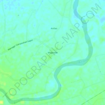
Name: Magindat topographic map, elevation, terrain.

Location: Magindat, Calapan, Oriental Mindoro, Mimaropa, Philippines (13.31320 121.20600 13.35320 121.24600)

Average elevation: 10 m

Minimum elevation: 4 m

Maximum elevation: 20 m

Other topographic maps

Click on a map to view its topography, its elevation and its terrain.

Masipit

Philippines > Oriental Mindoro > Calapan

Average elevation: 4 m

Lalud

Philippines > Oriental Mindoro > Calapan

Average elevation: 8 m

Tibag

Philippines > Oriental Mindoro > Calapan

Average elevation: 5 m

Santo Niño

Philippines > Oriental Mindoro > Calapan

Average elevation: 19 m

Camilmil

Philippines > Oriental Mindoro > Calapan

Average elevation: 12 m

Gear up for your next adventure:

🚲Heavy Duty Bike Lock - Secure your bike at the trailhead or during stops
👟Trail Running Shoes - Agile footwear for fast-paced topographic exploration
🛁Quick-Dry Microfiber Towel - Space-saving towel that dries rapidly on the move
🧭GPS Outdoor Watch - Smart watch for navigation and fitness tracking in nature
🛌Down Sleeping Bag - Superior warmth-to-weight ratio for cold nights

As an Amazon Associate, this site earns from qualifying purchases at no extra cost to you.