Geolocate

Blue Hills topographic map

Click on the map to display elevation.

About this map

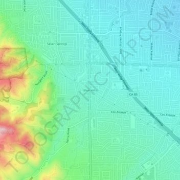
Name: Blue Hills topographic map, elevation, terrain.

Location: Blue Hills, Saratoga, Santa Clara County, California, 95014, United States (37.26800 -122.05218 37.30800 -122.01218)

Average elevation: 119 m

Minimum elevation: 66 m

Maximum elevation: 288 m

Other topographic maps

Click on a map to view its topography, its elevation and its terrain.

Gear up for your next adventure:

🧴Waterproofing Spray - Restore the DWR coating on jackets and tents
Camping Tent - Weather-resistant tents suitable for 2 to 6 people
🧰Multitool Knife - Compact and versatile tool for outdoor use
💧Filtered Water Bottle - Safe drinking water on the go
🥽Outdoor Goggles - Protective eyewear for outdoor activities

As an Amazon Associate, this site earns from qualifying purchases at no extra cost to you.