
Rattenberg topographic map
Interactive map
Click on the map to display elevation.
About this map
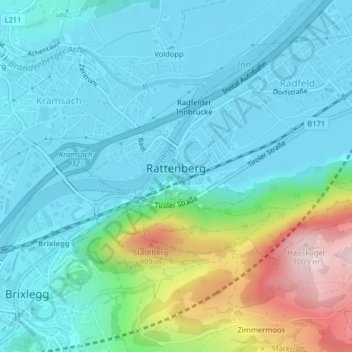
Name: Rattenberg topographic map, elevation, terrain.
Location: Rattenberg, Kufstein, Tyrol, 6240, Austria (47.43712 11.88942 47.44133 11.89563)
Average elevation: 613 m
Minimum elevation: 509 m
Maximum elevation: 1,001 m