Geolocate

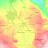
Malimbato topographic map

Click on the map to display elevation.

About this map

Name: Malimbato topographic map, elevation, terrain.

Location: Malimbato, Lanao del Norte, Northern Mindanao, 9222, Philippines (8.14409 124.27549 8.18409 124.31549)

Average elevation: 367 m

Minimum elevation: 97 m

Maximum elevation: 719 m

Other topographic maps

Click on a map to view its topography, its elevation and its terrain.
Agus River

Philippines > Lanao del Norte

Average elevation: 499 m

Linamon

Philippines > Lanao del Norte

Average elevation: 44 m

Kolambugan

Philippines > Lanao del Norte

Average elevation: 55 m

Baloi

Philippines > Lanao del Norte > Baloi

Average elevation: 393 m

Agus River

Philippines > Lanao del Norte > West Pantar

Average elevation: 536 m

Linamon

Philippines > Lanao del Norte

Average elevation: 44 m

Gear up for your next adventure:

🧥Packable Rain Jacket - Breathable waterproof layer for unpredictable weather
🗺️Topographic Maps - Detailed maps to explore trails, mountains, and wilderness areas
🧢Hiking Hat - Sun-protective and breathable hats for long treks
🛌Down Sleeping Bag - Superior warmth-to-weight ratio for cold nights
🥾Trekking Poles - Adjustable trekking poles to reduce knee stress and improve stability

As an Amazon Associate, this site earns from qualifying purchases at no extra cost to you.