
Barbosa topographic map
Click on the map to display elevation.
About this map
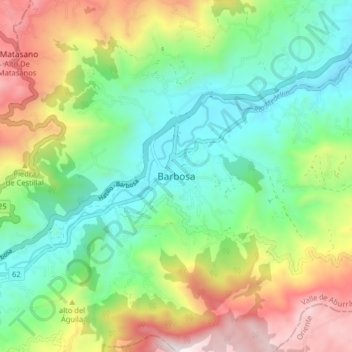
Name: Barbosa topographic map, elevation, terrain.
Location: Barbosa, Valle de Aburrá, Antioquia, Colombia (6.39702 -75.37138 6.47702 -75.29138)
Average elevation: 1,693 m
Minimum elevation: 1,233 m
Maximum elevation: 2,532 m