
Étang de Rabassoles topographic map
Interactive map
Click on the map to display elevation.
About this map
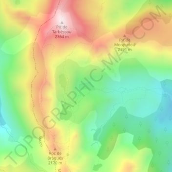
Name: Étang de Rabassoles topographic map, elevation, terrain.
Average elevation: 1,973 m
Minimum elevation: 1,667 m
Maximum elevation: 2,355 m
Other topographic maps
Click on a map to view its topography, its elevation and its terrain.
Étang de Balbonne
Étang de Balbonne, Route Forestière, Pujals, Mijanès, Foix, Ariège, Occitanie, France métropolitaine, 09460, France
Average elevation: 1,988 m