
Thank you for supporting this site ❤️
Make a donation
Make a donation
Gear up for your next adventure:
As an Amazon Associate, this site earns from qualifying purchases at no extra cost to you.
Treccione topographic map
Click on the map to display elevation.
Thank you for supporting this site ❤️
Make a donation
Make a donation
Gear up for your next adventure:
As an Amazon Associate, this site earns from qualifying purchases at no extra cost to you.
About this map
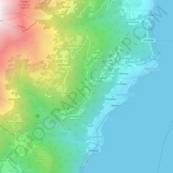
Name: Treccione topographic map, elevation, terrain.
Location: Treccione, Acquaseria, San Siro, Como, Lombardia, 22010, Italia (46.04589 9.23527 46.08589 9.27527)
Average elevation: 629 m
Minimum elevation: 195 m
Maximum elevation: 1,848 m
Thank you for supporting this site ❤️
Make a donation
Make a donation
Gear up for your next adventure:
As an Amazon Associate, this site earns from qualifying purchases at no extra cost to you.