
Thank you for supporting this site ❤️
Make a donation
Make a donation
Gear up for your next adventure:
As an Amazon Associate, this site earns from qualifying purchases at no extra cost to you.
Copperdale topographic map
Click on the map to display elevation.
Thank you for supporting this site ❤️
Make a donation
Make a donation
Gear up for your next adventure:
As an Amazon Associate, this site earns from qualifying purchases at no extra cost to you.
About this map
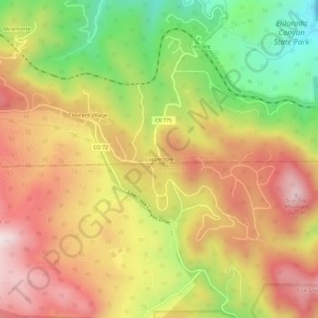
Name: Copperdale topographic map, elevation, terrain.
Location: Copperdale, Boulder County, Colorado, United States (39.89415 -105.36944 39.93415 -105.32944)
Average elevation: 2,399 m
Minimum elevation: 2,070 m
Maximum elevation: 2,677 m
Thank you for supporting this site ❤️
Make a donation
Make a donation
Gear up for your next adventure:
As an Amazon Associate, this site earns from qualifying purchases at no extra cost to you.