
Thank you for supporting this site ❤️
Make a donation
Make a donation
Gear up for your next adventure:
As an Amazon Associate, this site earns from qualifying purchases at no extra cost to you.
Cesariano topographic map
Click on the map to display elevation.
Thank you for supporting this site ❤️
Make a donation
Make a donation
Gear up for your next adventure:
As an Amazon Associate, this site earns from qualifying purchases at no extra cost to you.
About this map
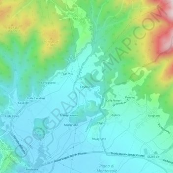
Name: Cesariano topographic map, elevation, terrain.
Location: Cesariano, Montereale, L'Aquila, 67014, Italia (42.51956 13.24979 42.55956 13.28979)
Average elevation: 935 m
Minimum elevation: 814 m
Maximum elevation: 1,324 m
Thank you for supporting this site ❤️
Make a donation
Make a donation
Gear up for your next adventure:
As an Amazon Associate, this site earns from qualifying purchases at no extra cost to you.