
Thank you for supporting this site ❤️
Make a donation
Make a donation
Gear up for your next adventure:
As an Amazon Associate, this site earns from qualifying purchases at no extra cost to you.
Perui topographic map
Click on the map to display elevation.
Thank you for supporting this site ❤️
Make a donation
Make a donation
Gear up for your next adventure:
As an Amazon Associate, this site earns from qualifying purchases at no extra cost to you.
About this map
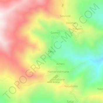
Name: Perui topographic map, elevation, terrain.
Location: Perui, Simbu, Highlands Region, Papua New Guinea (-6.27459 144.96637 -6.23459 145.00637)
Average elevation: 2,066 m
Minimum elevation: 1,620 m
Maximum elevation: 2,527 m
Thank you for supporting this site ❤️
Make a donation
Make a donation
Gear up for your next adventure:
As an Amazon Associate, this site earns from qualifying purchases at no extra cost to you.