
Opbrakel topographic map
Interactive map
Click on the map to display elevation.
About this map
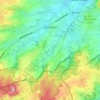
Name: Opbrakel topographic map, elevation, terrain.
Location: Opbrakel, Bracle, Audenarde, Flandre orientale, Belgique (50.76790 3.70268 50.79824 3.76551)
Average elevation: 76 m
Minimum elevation: 35 m
Maximum elevation: 150 m