

Tenali topographic map
Click on the map to display elevation.
Tenali
Tenali is situated at 16°14′20″N 80°38′42″E / 16.239°N 80.645°E / 16.239; 80.645, on the southern deltaic region of Krishna River. The city is spread over an area of 29.56 km2 (11.41 sq mi). It lies at an average altitude of 13 metres (43 ft) above mean sea level. It is also called as City without a National Highway. The East canal, the Nizampatnam canal and the West canal flow through the city, which originates from Krishna River. The region around the city forms a part of Western Delta System of Krishna river. The area is covered by Alluvium and the main soil varieties are Red and Black.
About this map
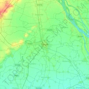
Name: Tenali topographic map, elevation, terrain.
Location: Tenali, Guntur, Andhra Pradesh, 522200, India (16.07777 80.48642 16.39777 80.80642)
Average elevation: 12 m
Minimum elevation: 3 m
Maximum elevation: 38 m