Geolocate

Babupur topographic map

Click on the map to display elevation.

About this map

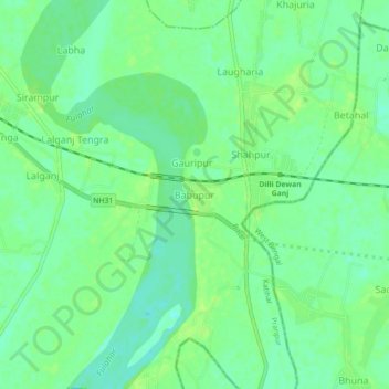
Name: Babupur topographic map, elevation, terrain.

Location: Babupur, Pranpur, Katihar, Bihar, 854117, India (25.41081 87.74885 25.45081 87.78885)

Average elevation: 28 m

Minimum elevation: 20 m

Maximum elevation: 35 m

Gear up for your next adventure:

Lightweight Backpacking Tent - Compact tent for efficient hiking trips
🥾Trekking Poles - Adjustable trekking poles to reduce knee stress and improve stability
🧦Outdoor Socks - Durable socks designed for hiking and outdoor sports
❄️Traction Ice Cleats - Slip-on spikes for icy trails and winter hiking
🎒Fully Waterproof Backpack - Total protection for photography gear and electronics

As an Amazon Associate, this site earns from qualifying purchases at no extra cost to you.