

Regensdorf topographic map
Click on the map to display elevation.
Regensdorf
Regensdorf sits in a plain, at an elevation of 443 metres (1,453 ft). The shallow east–west Furt valley in which it sits is surrounded by several hills. To the north is Regensberg (617 m (2,024 ft)), on which stands Regensberg Castle. To the northwest, beyond Buchs, is Lägern (866 metres (2,841 ft)). To the southwest is Altberg (632 metres (2,073 ft)), on the summit of which stands Waldschenke Altberg. To the south is Gubrist (615 metres (2,018 ft)), through which passes the A1 motorway via the Gubrist Tunnel.
About this map
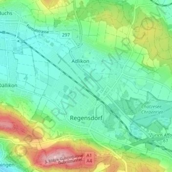
Name: Regensdorf topographic map, elevation, terrain.
Location: Regensdorf, Bezirk Dielsdorf, Zurich, Switzerland (47.41819 8.44077 47.46139 8.50304)
Average elevation: 472 m
Minimum elevation: 411 m
Maximum elevation: 620 m