Geolocate

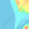
Nhive topographic map

Click on the map to display elevation.

About this map

Name: Nhive topographic map, elevation, terrain.

Location: Nhive, Malvan Taluka, Sindhudurg, Maharashtra, 416606, India (16.06132 73.46017 16.10132 73.50017)

Average elevation: 33 m

Minimum elevation: -1 m

Maximum elevation: 128 m

Other topographic maps

Click on a map to view its topography, its elevation and its terrain.
Dikwal

India > Maharashtra > Malvan Taluka

Average elevation: 103 m

Tarkarli beach

India > Maharashtra > Malvan Taluka > Tarkarli

Average elevation: 11 m

Gear up for your next adventure:

🧣Merino Neck Gaiter - Protects against wind, sun, and cold at high altitudes
🔦LED Flashlight - Powerful and long-lasting flashlight for camping and emergencies
⛺Camping Tent - Weather-resistant tents suitable for 2 to 6 people
🧣Evaporative Cooling Towel - Beat the heat during intense summer climbs
🌡️Emergency Mylar Blankets - Compact thermal protection for unexpected nights outdoors

As an Amazon Associate, this site earns from qualifying purchases at no extra cost to you.