
Glenside topographic map
Interactive map
Click on the map to display elevation.
About this map
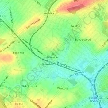
Name: Glenside topographic map, elevation, terrain.
Average elevation: 92 m
Minimum elevation: 62 m
Maximum elevation: 133 m
The altitude ranges from 232 feet near Glenside Memorial Hall to 405 feet on Sunset and Lindley Roads. The majority of Glenside is around 300 feet in elevation; it is 238 feet at the intersection of Waverly and Easton roads, the center of Glenside, Pennsylvania.