
Thank you for supporting this site ❤️
Make a donation
Make a donation
Gear up for your next adventure:
As an Amazon Associate, this site earns from qualifying purchases at no extra cost to you.
Heiligengrabe topographic map
Click on the map to display elevation.
Thank you for supporting this site ❤️
Make a donation
Make a donation
Gear up for your next adventure:
As an Amazon Associate, this site earns from qualifying purchases at no extra cost to you.
About this map
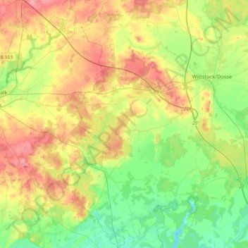
Name: Heiligengrabe topographic map, elevation, terrain.
Location: Heiligengrabe, Ostprignitz-Ruppin, Brandenburg, Deutschland (53.01463 12.28922 53.22865 12.51546)
Average elevation: 75 m
Minimum elevation: 39 m
Maximum elevation: 125 m
Thank you for supporting this site ❤️
Make a donation
Make a donation
Gear up for your next adventure:
As an Amazon Associate, this site earns from qualifying purchases at no extra cost to you.