Geolocate

Gogunda topographic map

Click on the map to display elevation.

About this map

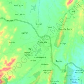
Name: Gogunda topographic map, elevation, terrain.

Location: Gogunda, Gogunda Tehsil, Udaipur District, Rajasthan, India (24.71771 73.48935 24.79771 73.56935)

Average elevation: 845 m

Minimum elevation: 729 m

Maximum elevation: 1,132 m

Gear up for your next adventure:

🥾Hiking Shoes - Durable and comfortable shoes for trail hiking
🧢Sun Hat - Wide-brim hat for sun protection
🔭Compact Binoculars - Lightweight optics for scouting trails and wildlife
🛁Quick-Dry Microfiber Towel - Space-saving towel that dries rapidly on the move
🗺️Topographic Maps - Detailed maps to explore trails, mountains, and wilderness areas

As an Amazon Associate, this site earns from qualifying purchases at no extra cost to you.