
Thank you for supporting this site ❤️
Make a donation
Make a donation
Gear up for your next adventure:
As an Amazon Associate, this site earns from qualifying purchases at no extra cost to you.
Corim topographic map
Click on the map to display elevation.
Thank you for supporting this site ❤️
Make a donation
Make a donation
Gear up for your next adventure:
As an Amazon Associate, this site earns from qualifying purchases at no extra cost to you.
About this map
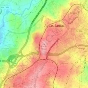
Name: Corim topographic map, elevation, terrain.
Location: Corim, Águas Santas, Maia, Porto, 4425-253, Portugal (41.20196 -8.57696 41.20206 -8.57686)
Average elevation: 113 m
Minimum elevation: 44 m
Maximum elevation: 158 m
Thank you for supporting this site ❤️
Make a donation
Make a donation
Gear up for your next adventure:
As an Amazon Associate, this site earns from qualifying purchases at no extra cost to you.