
Ripatransone topographic map
Click on the map to display elevation.
Ripatransone
The climate of Ripatransone is close to the Mediterranean: winters are colder and, although the hilly altitude limits the frequency of snowfalls, they occur more or less annually and can also be intense and lasting. Summers are generally cooler and more airy, with temperatures that are still quite high.
About this map
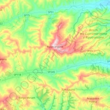
Name: Ripatransone topographic map, elevation, terrain.
Location: Ripatransone, Ascoli Piceno, Marche, 63065, Italy (42.94034 13.68345 43.03569 13.82945)
Average elevation: 197 m
Minimum elevation: 13 m
Maximum elevation: 495 m
Other topographic maps
Click on a map to view its topography, its elevation and its terrain.