Geolocate

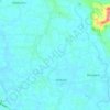
Pukkattupady topographic map

Click on the map to display elevation.

About this map

Name: Pukkattupady topographic map, elevation, terrain.

Location: Pukkattupady, Aluva, Ernakulam, Kerala, 683561, India (10.03929 76.37498 10.07929 76.41498)

Average elevation: 12 m

Minimum elevation: -3 m

Maximum elevation: 64 m

Other topographic maps

Click on a map to view its topography, its elevation and its terrain.
Mookkannoor

India > Kerala > Aluva > Ezhattumugham

Average elevation: 31 m

Thuravoor (Ernakulam)

India > Kerala > Aluva > Thuravoor

Average elevation: 22 m

Choornikkara

India > Kerala > Aluva > Aluva

Average elevation: 10 m

Sreemoolanagaram

India > Kerala > Aluva > Thuruth

Average elevation: 11 m

Choornikkara

India > Kerala > Aluva > Aluva

Average elevation: 10 m

Sreemoolanagaram

India > Kerala > Aluva > Thuruth

Average elevation: 11 m

Gear up for your next adventure:

🛰️Satellite Messenger - Emergency communication for areas with no cell service
🧥Fleece Jacket - Warm and lightweight jacket for layering
🧳Compression Sacks - Maximize space in your backpack by shrinking gear
🛌Insulated Sleeping Pad - Critical thermal barrier between you and the cold ground
🥾Durable Hiking Shoes - Long-lasting shoes for frequent hiking

As an Amazon Associate, this site earns from qualifying purchases at no extra cost to you.