Geolocate

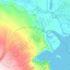
At Tannumah topographic map

Click on the map to display elevation.

About this map

Name: At Tannumah topographic map, elevation, terrain.

Location: At Tannumah, Shatt Al-Arab Central Sbudsitrict, Shatt Al-Arab District, Basra Governorate, 10002, Iraq (30.48708 47.82085 30.56708 47.90085)

Average elevation: 3 m

Minimum elevation: -3 m

Maximum elevation: 12 m

Other topographic maps

Click on a map to view its topography, its elevation and its terrain.

حي صنعاء

Iraq > Basra Governorate

Average elevation: 5 m

Al-Basrah District

Iraq > Basra Governorate

Average elevation: 7 m

Safwan Subdistrict

Iraq > Basra Governorate

Average elevation: 55 m

Gear up for your next adventure:

🥾Trail Hiking Boots - Supportive boots for rough trails
💧Filtered Water Bottle - Safe drinking water on the go
🥾Hiking Leggings - Comfortable leggings for outdoor activities
🧦Hiking Socks - Moisture-wicking and comfortable socks for long hikes
🦶Hiking Shoe Insoles - Added support for high arches and long days on feet

As an Amazon Associate, this site earns from qualifying purchases at no extra cost to you.