Geolocate

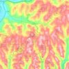
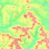
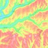
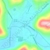
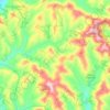
Bovina Center topographic map

Click on the map to display elevation.

About this map

Name: Bovina Center topographic map, elevation, terrain.

Location: Bovina Center, Town of Bovina, Delaware County, New York, 13740, United States (42.24203 -74.80460 42.28203 -74.76460)

Average elevation: 600 m

Minimum elevation: 481 m

Maximum elevation: 837 m

Other topographic maps

Click on a map to view its topography, its elevation and its terrain.
Town of Bovina

United States > New York > Delaware County

The town has some of the highest uplands in the county. The elevation of the highest point exceeds 3,340 feet (1,020 m) above sea level, on an unnamed summit at the eastern corner of the town overlooking the Plattekill Mountain ski area in neighboring Roxbury.

Average elevation: 670 m

Bloomville

United States > New York > Delaware County

Average elevation: 519 m

Town of Delhi

United States > New York > Delaware County

Average elevation: 585 m

Downsville

United States > New York > Delaware County

Average elevation: 474 m

Town of Andes

United States > New York > Delaware County

Average elevation: 615 m

Town of Delhi

United States > New York > Delaware County

Average elevation: 585 m

Town of Andes

United States > New York > Delaware County

Average elevation: 615 m

Downsville

United States > New York > Delaware County

Average elevation: 474 m

Town of Andes

United States > New York > Delaware County

Average elevation: 615 m

Stamford

United States > New York > Delaware County > Stamford

Average elevation: 598 m

Gear up for your next adventure:

🧥Softshell Jacket - Windproof and breathable jacket for hiking
⛺Camping Groundsheet - Protect your tent from moisture and dirt
🧢Hiking Hat - Sun-protective and breathable hats for long treks
🧢Hiking Sun Hat - Wide-brimmed protection for exposed mountain ridges
🦶Anti-Blister Balm - Prevents friction and hotspots during long ascents

As an Amazon Associate, this site earns from qualifying purchases at no extra cost to you.