Geolocate

Floridia topographic map

Click on the map to display elevation.

About this map

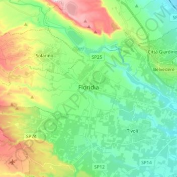
Name: Floridia topographic map, elevation, terrain.

Location: Floridia, Siracusa, Sicily, 96014, Italy (37.06384 15.04034 37.09821 15.17270)

Average elevation: 141 m

Minimum elevation: 2 m

Maximum elevation: 457 m

Other topographic maps

Click on a map to view its topography, its elevation and its terrain.

Syracuse

Italy > Sicily > Siracusa > Syracuse

Average elevation: 48 m

Gear up for your next adventure:

🔥Emergency Fire Starter - Reliable ignition source for all weather conditions
🏕️Camping Hammock - Integrated protection for sleeping between trees
🧢Sun Hat - Wide-brim hat for sun protection
🥤Collapsible Travel Cup - Saves space and weight in your mess kit
🥾Mountaineering Boots - Supportive boots for climbing and high-altitude hiking

As an Amazon Associate, this site earns from qualifying purchases at no extra cost to you.