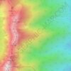
Minamimaki topographic map
Click on the map to display elevation.
Minamimaki
Minamimaki is located in the Southern Yatsugatake Volcanic Group of the mountainous eastern Nagano Prefecture at an average altitude of between 1,000 and 1,500 meters. It is bordered by Yamanashi Prefecture to the south.
About this map

Name: Minamimaki topographic map, elevation, terrain.
Location: Minamimaki, Minamisaku County, Nagano Prefecture, Japan (35.89619 138.35912 36.05333 138.55871)
Average elevation: 1,557 m
Minimum elevation: 925 m
Maximum elevation: 2,878 m
Other topographic maps
Click on a map to view its topography, its elevation and its terrain.