Geolocate

Mengjiang topographic map

Click on the map to display elevation.

About this map

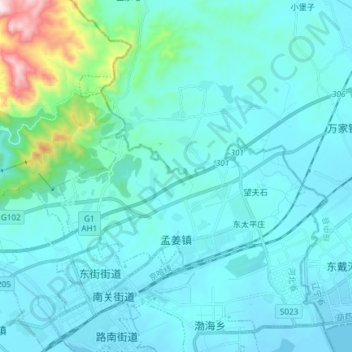
Name: Mengjiang topographic map, elevation, terrain.

Location: Mengjiang, Shanhaiguan District, Qinhuangdao, Hebei, China (40.00637 119.69118 40.07187 119.83972)

Average elevation: 90 m

Minimum elevation: -4 m

Maximum elevation: 818 m

Other topographic maps

Click on a map to view its topography, its elevation and its terrain.

Yang River

China > Hebei > Qinhuangdao

Average elevation: 99 m

Gear up for your next adventure:

🧰Multitool Knife - Compact and versatile tool for outdoor use
🔭Outdoor Binoculars - Lightweight binoculars for birdwatching and hiking
🔨Vehicle Emergency Tool - Safety tool for remote road trips to trailheads
🥾Mountain Hiking Shoes - Shoes with superior grip for mountainous terrain
💧Hydration Pack - Hands-free hydration system for long hikes

As an Amazon Associate, this site earns from qualifying purchases at no extra cost to you.