
Vidra topographic map
Interactive map
Click on the map to display elevation.
About this map
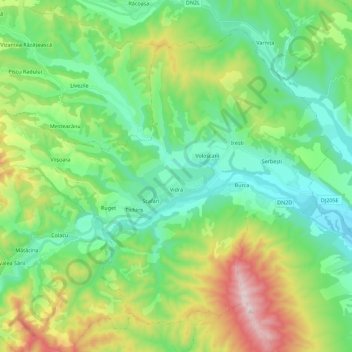
Name: Vidra topographic map, elevation, terrain.
Location: Vidra, Vrancea, Rumänien (45.85007 26.77863 45.98103 27.00245)
Average elevation: 414 m
Minimum elevation: 182 m
Maximum elevation: 986 m
Other topographic maps
Click on a map to view its topography, its elevation and its terrain.