Geolocate

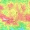
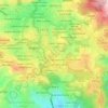
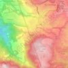
SLU SVP topographic map

Click on the map to display elevation.

About this map

Name: SLU SVP topographic map, elevation, terrain.

Location: SLU SVP, District 14, Baguio, Cordillera Administrative Region, 2600, Philippines (16.38665 120.58723 16.39338 120.59268)

Average elevation: 1,370 m

Minimum elevation: 1,172 m

Maximum elevation: 1,543 m

Other topographic maps

Click on a map to view its topography, its elevation and its terrain.

Pacdal Circle Park

Philippines > Baguio

Average elevation: 1,482 m

Burnham Park

Philippines > Baguio

Average elevation: 1,445 m

Upper Magsaysay

Philippines > Baguio > Upper Magsaysay

Average elevation: 1,456 m

Ferdinand

Philippines > Baguio

Average elevation: 1,416 m

Palma - Urbano

Philippines > Baguio

Average elevation: 1,432 m

Salud Mitra

Philippines > Baguio

Average elevation: 1,444 m

Harrison-Claudio-Carantes

Philippines > Baguio

Average elevation: 1,446 m

Panagbenga Park

Philippines > Baguio

Average elevation: 1,442 m

Dominican Hill

Philippines > Baguio

Average elevation: 1,434 m

Poblacion

Philippines > Baguio

Average elevation: 1,292 m

Bayan Park

Philippines > Baguio

Average elevation: 1,470 m

Pine Trees of the World Park

Philippines > Baguio

Average elevation: 1,436 m

Lagoon Tunnel

Philippines > Baguio

Average elevation: 1,421 m

Mines View Park

Philippines > Baguio

Average elevation: 1,439 m

Tam-Awan Village

Philippines > Baguio

Average elevation: 1,430 m

Gear up for your next adventure:

🥫Freeze-Dried Meals - Lightweight, high-calorie nutrition for multi-day treks
🧦Thermal Socks - Warm socks for winter hiking or camping
⛺Tent Footprint - Protect tent floor and increase durability
❄️Traction Ice Cleats - Slip-on spikes for icy trails and winter hiking
🛌Insulated Sleeping Pad - Critical thermal barrier between you and the cold ground

As an Amazon Associate, this site earns from qualifying purchases at no extra cost to you.