Geolocate

Cádavas topographic map

Click on the map to display elevation.

About this map

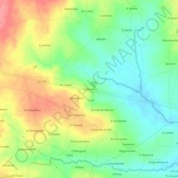
Name: Cádavas topographic map, elevation, terrain.

Location: Cádavas, Rioaveso, Vilalba, Terra Chá, Lugo, Galicia, Spain (43.26260 -7.62153 43.30260 -7.58153)

Average elevation: 438 m

Minimum elevation: 401 m

Maximum elevation: 490 m

Other topographic maps

Click on a map to view its topography, its elevation and its terrain.

Vilapedre

Spain > Galicia > Terra Chá > Vilalba

Average elevation: 634 m

Gear up for your next adventure:

🧴Insect Repellent - Protect yourself from bugs during outdoor adventures
🥾Waterproof Trail Shoes - Shoes designed to handle wet terrain
🥾Trail Hiking Socks - Comfortable socks to prevent blisters and fatigue
🧢Sun Hat - Wide-brim hat for sun protection
🧭GPS Tracker - Track your location in remote areas safely

As an Amazon Associate, this site earns from qualifying purchases at no extra cost to you.