Geolocate

Meghrej topographic map

Click on the map to display elevation.

About this map

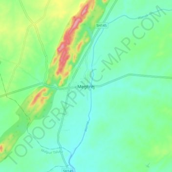
Name: Meghrej topographic map, elevation, terrain.

Location: Meghrej, Meghraj Taluka, Aravalli, Gujarat, 383350, India (23.45480 73.47265 23.53480 73.55265)

Average elevation: 178 m

Minimum elevation: 145 m

Maximum elevation: 268 m

Gear up for your next adventure:

👖Convertible Hiking Pants - Zip-off legs to adapt to changing weather conditions
🧦Thermal Socks - Warm socks for winter hiking or camping
🎒Hiking Daypack - Lightweight and durable backpacks for day trips and excursions
🦶Anti-Blister Balm - Prevents friction and hotspots during long ascents
Camping Tent - Weather-resistant tents suitable for 2 to 6 people

As an Amazon Associate, this site earns from qualifying purchases at no extra cost to you.