
Thank you for supporting this site ❤️
Make a donation
Make a donation
Gear up for your next adventure:
As an Amazon Associate, this site earns from qualifying purchases at no extra cost to you.
Outeiro topographic map
Click on the map to display elevation.
Thank you for supporting this site ❤️
Make a donation
Make a donation
Gear up for your next adventure:
As an Amazon Associate, this site earns from qualifying purchases at no extra cost to you.
About this map
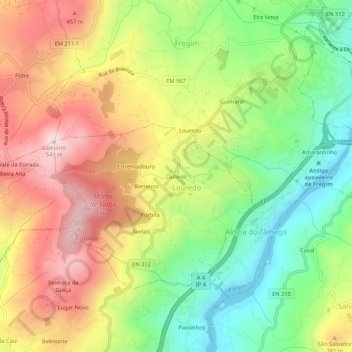
Name: Outeiro topographic map, elevation, terrain.
Location: Outeiro, Louredo, Amarante, Porto, 4600-593, Portugal (41.23506 -8.13862 41.27506 -8.09862)
Average elevation: 279 m
Minimum elevation: 56 m
Maximum elevation: 530 m
Thank you for supporting this site ❤️
Make a donation
Make a donation
Gear up for your next adventure:
As an Amazon Associate, this site earns from qualifying purchases at no extra cost to you.