Geolocate

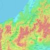
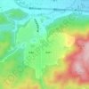
Kashima topographic map

Click on the map to display elevation.

About this map

Name: Kashima topographic map, elevation, terrain.

Location: Kashima, Ibaraki Prefecture, Japan (35.92793 140.55382 36.15375 140.95856)

Average elevation: 8 m

Minimum elevation: -4 m

Maximum elevation: 54 m

Other topographic maps

Click on a map to view its topography, its elevation and its terrain.
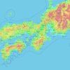
Osaka Prefecture

Japan

Average elevation: 188 m

300M

Japan > Nagasaki

Average elevation: 220 m

Akaishi Mountains

Japan > Oshika

Average elevation: 2,591 m

Iwo to

Japan > Tokyo > Ogasawara

Average elevation: 0 m

Takeda Castle

Japan > Asago

Average elevation: 174 m

葭町

Japan > Matsumoto

Average elevation: 616 m

Nakauonuma County

Japan

Average elevation: 605 m

Nishikigaoka-chuo Park

Japan > Sendai

Average elevation: 197 m

Mount Yatsugatake viewpoint

Japan > Suwa County > Fujimi

Average elevation: 1,742 m

Gear up for your next adventure:

🦶Hiking Shoe Insoles - Added support for high arches and long days on feet
⛺Tent Footprint - Protect tent floor and increase durability
☕Camping Coffee Maker - Brew fresh coffee anywhere on the topographic map
🥾Waterproof Hiking Boots - Boots keeping your feet dry in wet conditions
🔋Lithium AA Batteries - Long-lasting power that performs in extreme cold

As an Amazon Associate, this site earns from qualifying purchases at no extra cost to you.