Geolocate

Hebbale topographic map

Click on the map to display elevation.

About this map

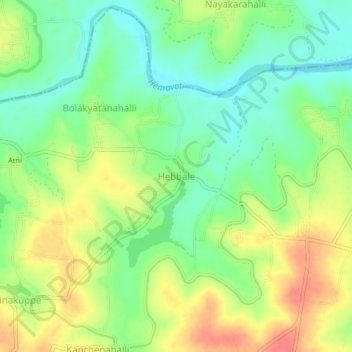
Name: Hebbale topographic map, elevation, terrain.

Location: Hebbale, Arakalagudu taluk, Hassan, Karnataka, India (12.78685 76.09624 12.82685 76.13624)

Average elevation: 867 m

Minimum elevation: 841 m

Maximum elevation: 898 m

Gear up for your next adventure:

🎒Hiking Backpack - Lightweight and ergonomic backpacks for day hikes or multi-day treks
🥾Waterproof Hiking Shoes - Durable shoes for wet and rugged trails
🧰Multitool Knife - Compact and versatile tool for outdoor use
🧥Softshell Jacket - Windproof and breathable jacket for hiking
🧭GPS Outdoor Watch - Smart watch for navigation and fitness tracking in nature

As an Amazon Associate, this site earns from qualifying purchases at no extra cost to you.