Geolocate

Meckelfeld topographic map

Click on the map to display elevation.

About this map

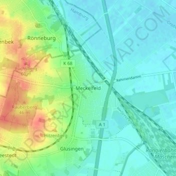
Name: Meckelfeld topographic map, elevation, terrain.

Location: Meckelfeld, Seevetal, Harburg, Lower Saxony, 21217, Germany (53.40181 10.00423 53.44181 10.04423)

Average elevation: 17 m

Minimum elevation: -1 m

Maximum elevation: 60 m

Gear up for your next adventure:

👖Convertible Hiking Pants - Zip-off legs to adapt to changing weather conditions
🧥Waterproof Hiking Jacket - Protect yourself from rain and wind while hiking
🥾Waterproof Hiking Shoes - Durable shoes for wet and rugged trails
❄️Traction Ice Cleats - Slip-on spikes for icy trails and winter hiking
💡LED Camping Lantern - Illuminate your campsite with long-lasting lanterns

As an Amazon Associate, this site earns from qualifying purchases at no extra cost to you.