Geolocate

Kemirirejo topographic map

Click on the map to display elevation.

About this map

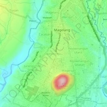
Name: Kemirirejo topographic map, elevation, terrain.

Location: Kemirirejo, Magelang, Central Java, Java, 56122, Indonesia (-7.50589 110.19499 -7.46589 110.23499)

Average elevation: 360 m

Minimum elevation: 296 m

Maximum elevation: 496 m

Gear up for your next adventure:

Camping Coffee Maker - Brew fresh coffee anywhere on the topographic map
🥾Approach Boots - Comfortable boots for hiking and climbing approaches
🔦LED Flashlight - Powerful and long-lasting flashlight for camping and emergencies
Backpacking Tent - Lightweight tent for long-distance hiking trips
🧊Insulated Water Bottle - Keeps drinks cold in summer and prevents freezing in winter

As an Amazon Associate, this site earns from qualifying purchases at no extra cost to you.