Geolocate

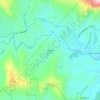
Toxaway River topographic map

Click on the map to display elevation.

About this map

Name: Toxaway River topographic map, elevation, terrain.

Location: Toxaway River, Transylvania County, North Carolina, United States (35.07100 -82.99115 35.15820 -82.88527)

Average elevation: 869 m

Minimum elevation: 346 m

Maximum elevation: 1,448 m

Other topographic maps

Click on a map to view its topography, its elevation and its terrain.
Gear up for your next adventure:

🧥Waterproof Pants - Keep dry during rainy hiking conditions
🧰Survival Kit - Essential gear for emergencies in the wilderness
⛺Backpacking Tent - Lightweight tent for long-distance hiking trips
🦯Trekking Poles - Reduced impact on joints for steep topographic climbs
🥾Approach Shoes - Shoes designed for climbing approaches and rugged trails

As an Amazon Associate, this site earns from qualifying purchases at no extra cost to you.