Geolocate

Brownwood topographic map

Click on the map to display elevation.

About this map

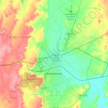
Name: Brownwood topographic map, elevation, terrain.

Location: Brownwood, Brown County, Texas, 76801, United States (31.65910 -99.01309 31.80845 -98.94199)

Average elevation: 439 m

Minimum elevation: 395 m

Maximum elevation: 499 m

Other topographic maps

Click on a map to view its topography, its elevation and its terrain.

May

United States > Texas > Brown County

Average elevation: 506 m

Zephyr

United States > Texas > Brown County > Zephyr

Average elevation: 460 m

Gear up for your next adventure:

🔭Outdoor Binoculars - Lightweight binoculars for birdwatching and hiking
🛏️Sleeping Bag - Warm and compact sleeping bags for outdoor camping
🧦Crew Hiking Socks - Comfortable socks for long-distance hikes
🔦LED Headtorch - Bright and durable light for night activities
🧰Emergency Multi-Tool - Compact multi-tool for outdoor survival

As an Amazon Associate, this site earns from qualifying purchases at no extra cost to you.