
Quận Bình Thạnh topographic map
Interactive map
Click on the map to display elevation.
About this map
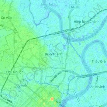
Name: Quận Bình Thạnh topographic map, elevation, terrain.
Location: Quận Bình Thạnh, Ho Chi Minhstad, Vietnam (10.78539 106.68386 10.83913 106.75138)
Average elevation: 7 m
Minimum elevation: -3 m
Maximum elevation: 35 m
Other topographic maps
Click on a map to view its topography, its elevation and its terrain.
Ho Chi Minhstad
Sài Gòn, Quận 1, Ho Chi Minhstad, 082, Vietnam
Average elevation: 5 m