Geolocate

Chehaima topographic map

Click on the map to display elevation.

About this map
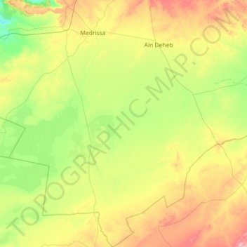
Name: Chehaima topographic map, elevation, terrain.

Location: Chehaima, Aïn Deheb District, Tiaret, Algeria (34.07332 1.16317 35.01611 1.57578)

Average elevation: 1,083 m

Minimum elevation: 859 m

Maximum elevation: 1,650 m

Other topographic maps

Click on a map to view its topography, its elevation and its terrain.

Naima

Algeria > Tiaret > Aïn Deheb District > Naima

Average elevation: 1,215 m

Gear up for your next adventure:

⛺Bushcraft Tarp - Versatile emergency shelter or gear protection
🛶Kayak Accessories - Essential gear for safe and fun kayaking adventures
🩹Compact First Aid Kit - Pre-packed essentials for common trail injuries
🥾Durable Hiking Shoes - Long-lasting shoes for frequent hiking
🧦Merino Wool Socks - Moisture-wicking comfort for long-distance hiking

As an Amazon Associate, this site earns from qualifying purchases at no extra cost to you.