Geolocate

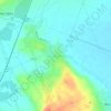
Hassi Mefsoukh topographic map

Click on the map to display elevation.

About this map

Name: Hassi Mefsoukh topographic map, elevation, terrain.

Location: Hassi Mefsoukh, Gdyel District, Oran, 31000, Algeria (35.73823 -0.39755 35.81786 -0.28600)

Average elevation: 121 m

Minimum elevation: 46 m

Maximum elevation: 319 m

Other topographic maps

Click on a map to view its topography, its elevation and its terrain.
Hassiane Etoual

Algeria > Oran > Gdyel District > Ben Freha

Average elevation: 104 m

Gear up for your next adventure:

🗺️Topographic Maps - Detailed maps to explore trails, mountains, and wilderness areas
🏃Hydration Running Vest - Carry water and maps close to your body for speed
⛺Bushcraft Tarp - Versatile emergency shelter or gear protection
🛰️Satellite Messenger - Emergency communication for areas with no cell service
🥾Lightweight Hiking Shoes - Comfortable shoes for day hikes

As an Amazon Associate, this site earns from qualifying purchases at no extra cost to you.