
Thank you for supporting this site ❤️
Make a donation
Make a donation
Gear up for your next adventure:
As an Amazon Associate, this site earns from qualifying purchases at no extra cost to you.
Huanacaure topographic map
Click on the map to display elevation.
Thank you for supporting this site ❤️
Make a donation
Make a donation
Gear up for your next adventure:
As an Amazon Associate, this site earns from qualifying purchases at no extra cost to you.
About this map
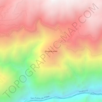
Name: Huanacaure topographic map, elevation, terrain.
Location: Huanacaure, San Pablo de Pillao, Huánuco, Perú (-9.79575 -75.93577 -9.75575 -75.89577)
Average elevation: 2,552 m
Minimum elevation: 1,508 m
Maximum elevation: 3,364 m
Thank you for supporting this site ❤️
Make a donation
Make a donation
Gear up for your next adventure:
As an Amazon Associate, this site earns from qualifying purchases at no extra cost to you.