
Ban Chang topographic map
Interactive map
Click on the map to display elevation.
About this map
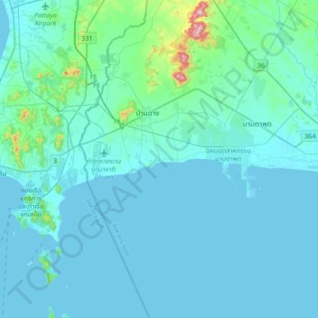
Name: Ban Chang topographic map, elevation, terrain.
Location: Ban Chang, Rayong Province, 21130, Thailand (12.51857 100.90714 12.83857 101.22714)
Average elevation: 32 m
Minimum elevation: -3 m
Maximum elevation: 406 m
Other topographic maps
Click on a map to view its topography, its elevation and its terrain.
Map Ta Phut
Map Ta Phut, Thap Ma, Rayong Province, 21150, Thailand
Average elevation: 24 m
Rayong
Rayong, Choeng Noen, Rayong Province, 21000, Thailand
Average elevation: 31 m