Geolocate

Dharni topographic map

Click on the map to display elevation.

About this map

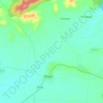
Name: Dharni topographic map, elevation, terrain.

Location: Dharni, Amravati, Maharashtra, India (21.54183 76.87378 21.58294 76.90661)

Average elevation: 327 m

Minimum elevation: 299 m

Maximum elevation: 414 m

Gear up for your next adventure:

🥾Mountain Hiking Shoes - Shoes with superior grip for mountainous terrain
🧤Thermal Hiking Gloves - Grip-enhanced gloves for cold-weather altitude trekking
🧥Thermal Layer - Insulating layer for cold outdoor conditions
🧣Evaporative Cooling Towel - Beat the heat during intense summer climbs
🔭Compact Binoculars - Lightweight optics for scouting trails and wildlife

As an Amazon Associate, this site earns from qualifying purchases at no extra cost to you.