
Thank you for supporting this site ❤️
Make a donation
Make a donation
Gear up for your next adventure:
As an Amazon Associate, this site earns from qualifying purchases at no extra cost to you.
Mayfair topographic map
Click on the map to display elevation.
Thank you for supporting this site ❤️
Make a donation
Make a donation
Gear up for your next adventure:
As an Amazon Associate, this site earns from qualifying purchases at no extra cost to you.
About this map
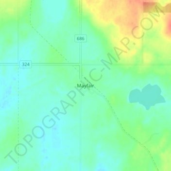
Name: Mayfair topographic map, elevation, terrain.
Location: Mayfair, Meeting Lake No. 466, Saskatchewan, Canada (52.96285 -107.61838 53.00285 -107.57838)
Average elevation: 699 m
Minimum elevation: 686 m
Maximum elevation: 728 m
Thank you for supporting this site ❤️
Make a donation
Make a donation
Gear up for your next adventure:
As an Amazon Associate, this site earns from qualifying purchases at no extra cost to you.