Geolocate

Genthin topographic map

Click on the map to display elevation.

About this map

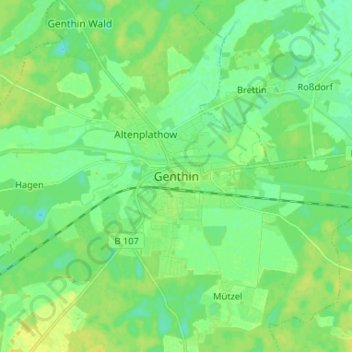
Name: Genthin topographic map, elevation, terrain.

Location: Genthin, Jerichower Land, Saxony-Anhalt, 39307, Germany (52.36637 12.11617 52.44637 12.19617)

Average elevation: 36 m

Minimum elevation: 28 m

Maximum elevation: 46 m

Gear up for your next adventure:

🧴Insect Repellent - Protect yourself from bugs during outdoor adventures
🔋Lithium AA Batteries - Long-lasting power that performs in extreme cold
🧦Merino Wool Socks - Moisture-wicking comfort for long-distance hiking
🧰Survival Kit - Essential gear for emergencies in the wilderness
❄️Traction Ice Cleats - Slip-on spikes for icy trails and winter hiking

As an Amazon Associate, this site earns from qualifying purchases at no extra cost to you.