Geolocate

Staudach topographic map

Click on the map to display elevation.

About this map

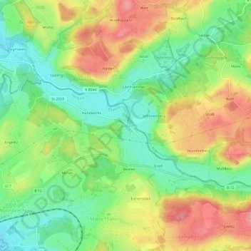
Name: Staudach topographic map, elevation, terrain.

Location: Staudach, Hergatz, Landkreis Lindau, Bavaria, 88145, Germany (47.65046 9.85997 47.69046 9.89997)

Average elevation: 611 m

Minimum elevation: 557 m

Maximum elevation: 678 m

Other topographic maps

Click on a map to view its topography, its elevation and its terrain.

Lindau (Bodensee)

Germany > Bavaria > Landkreis Lindau

Average elevation: 448 m

Lindau (Bodensee)

Germany > Bavaria > Landkreis Lindau

Average elevation: 448 m

Hergatz

Germany > Bavaria > Landkreis Lindau

Average elevation: 616 m

Lindau (Bodensee)

Germany > Bavaria > Landkreis Lindau

Average elevation: 448 m

Opfenbach

Germany > Bavaria > Landkreis Lindau

Average elevation: 597 m

Oberreute

Germany > Bavaria > Landkreis Lindau

Average elevation: 830 m

Gestratz

Germany > Bavaria > Landkreis Lindau > Gestratz

Average elevation: 698 m

Gear up for your next adventure:

🛶Kayak Dry Bag - Waterproof storage for kayaking adventures
🧊Portable Cooler - Keep food and drinks cold during outdoor adventures
🩹Compact First Aid Kit - Pre-packed essentials for common trail injuries
🔭Compact Binoculars - Lightweight optics for scouting trails and wildlife
🚲Heavy Duty Bike Lock - Secure your bike at the trailhead or during stops

As an Amazon Associate, this site earns from qualifying purchases at no extra cost to you.