Geolocate

Mount Futago topographic map

Click on the map to display elevation.

About this map

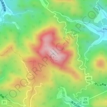
Name: Mount Futago topographic map, elevation, terrain.

Location: Mount Futago, Kunisaki, Oita Prefecture, Japan (33.58300 131.60151 33.58310 131.60161)

Average elevation: 404 m

Minimum elevation: 185 m

Maximum elevation: 691 m

Gear up for your next adventure:

💧Reusable Water Bottle - Durable water bottles for hydration on trails
🥾Hiking Shorts - Breathable shorts suitable for summer hikes
🧥Softshell Hiking Jacket - The perfect balance of wind protection and breathability
🧰Survival Kit - Essential gear for emergencies in the wilderness
🧢Outdoor Cap - Protective cap for sun and rain during hikes

As an Amazon Associate, this site earns from qualifying purchases at no extra cost to you.