Geolocate

Castelfidardo topographic map

Click on the map to display elevation.

About this map

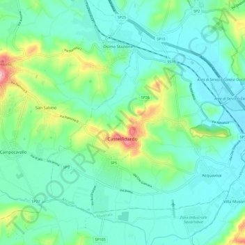
Name: Castelfidardo topographic map, elevation, terrain.

Location: Castelfidardo, Ancona, Marche, 60022, Italy (43.43932 13.51093 43.50067 13.62425)

Average elevation: 52 m

Minimum elevation: 2 m

Maximum elevation: 229 m

Gear up for your next adventure:

🥾Mountaineering Boots - Supportive boots for climbing and high-altitude hiking
🔦UV Flashlight - Detect minerals or specific insects in the dark
🥾Light Hiking Boots - Lightweight and comfortable boots for day hikes
Lightweight Backpacking Tent - Compact tent for efficient hiking trips
🥫Freeze-Dried Meals - Lightweight, high-calorie nutrition for multi-day treks

As an Amazon Associate, this site earns from qualifying purchases at no extra cost to you.