Geolocate

Sion topographic map

Click on the map to display elevation.

About this map

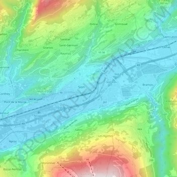
Name: Sion topographic map, elevation, terrain.

Location: Sion, Wallis, 1950, Switzerland (46.20473 7.30536 46.25585 7.42527)

Average elevation: 818 m

Minimum elevation: 477 m

Maximum elevation: 1,889 m

Gear up for your next adventure:

🔭Compact Monocular - One-handed bird watching and trail spotting
🌬️Windproof Camp Stove - Efficient cooking even on exposed mountain peaks
🥾Trekking Boots - Durable boots for long-distance trekking
🛶Kayak Accessories - Essential gear for safe and fun kayaking adventures
🛏️Sleeping Bag - Warm and compact sleeping bags for outdoor camping

As an Amazon Associate, this site earns from qualifying purchases at no extra cost to you.