Geolocate

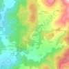
Arcos topographic map

Click on the map to display elevation.

About this map

Name: Arcos topographic map, elevation, terrain.

Location: Arcos, Castroverde, Lugo, Galicia, España (42.98983 -7.40154 43.01380 -7.36978)

Average elevation: 499 m

Minimum elevation: 448 m

Maximum elevation: 634 m

Other topographic maps

Click on a map to view its topography, its elevation and its terrain.

Páramo

España > Galicia > Lugo > Castroverde

Average elevation: 696 m

San Fitoiro

España > Galicia > Lugo > Castroverde

Average elevation: 697 m

Tórdea

España > Galicia > Lugo > Castroverde

Average elevation: 528 m

San Cosme de Barreiros

España > Galicia > Lugo > Castroverde

Average elevation: 622 m

O Latadal

España > Galicia > Lugo > Castroverde

Average elevation: 796 m

Vilar dos Naraos

España > Galicia > Lugo > Castroverde

Average elevation: 558 m

Gear up for your next adventure:

🥾Waterproof Hiking Boots - Essential footwear for rugged terrain and wet Canadian trails
🐕Hiking Dog Pack - Let your canine companion carry their own water and food
🛏️Camping Sleeping Mat - Comfortable mats for sleeping outdoors
💡Compact LED Flashlight - Powerful and portable flashlight for outdoor use
🧢Sun Hat - Wide-brim hat for sun protection

As an Amazon Associate, this site earns from qualifying purchases at no extra cost to you.